Cycle The Loop-Otago Harbour Cycleway Map And Ferry
(Te Aka Otakuo-The Otago Vine)
Cycling the Otago Harbour Loop – Dunedin Cycleway
The Otago Harbour Loop is one of Dunedin’s most scenic and accessible rides. Located in Dunedin, the cycleway follows both sides of Otago Harbour, offering a mix of coastal views, wildlife, and relaxed riding.
The harbour is surrounded by sandflats and hills on both sides, with two islands marking its midway point. The trail extends from Dunedin’s Steamer Basin in the central city, heading north towards Taiaroa Head Nature Reserve at the harbour entrance. Port Chalmers sits on the western side, with the Otago Peninsula on the eastern side.
The cycle trail runs from Steamer Basin along the western harbour to Port Chalmers township and the main container port, and continues towards Aramoana sandspit. The main cycleway between Port Chalmers and Portobello is approximately 32km, mostly flat, paved, and off-road, with only a small on-road section in Port Chalmers and some sections in Dunedin when joining from bike hire locations.
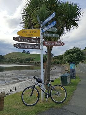
Please note that you will need to book the Port to Port Cycle Ferry to complete the loop, as there is a 3km section across the harbour. The ferry connects Back Beach, Port Chalmers with Portobello, allowing cyclists to complete the full loop.
While the full ride, including additional sections beyond the main ports, is around 54km, the route can be shortened to suit a range of abilities. The 32km harbour loop is a popular option, combining cycling with the ferry crossing.
The route is mostly flat and easy-going, with optional hill sections for those wanting more of a challenge and elevated views. Along the way, cyclists can enjoy some of the best scenery in Dunedin, with opportunities for photography, cafés, beaches, local attractions, and plenty of birdlife and harbour activity.
See the side tabs on this website for information and links for the best places to eat, rent bikes and support local businesses along the way. And FAQs for tips and answers to your questions.
Route
Cycleway Colours
The yellow line is the shared cycleway/path. Approx 32 kms, paved and mostly flat.
The red line in
currently unfinished cycleway.